")

Environmental Geology in Spain - Reimagining the landscape
22.02.2016
Newsfeed of the day
by Maya Schmitt
Reimagining the landscape
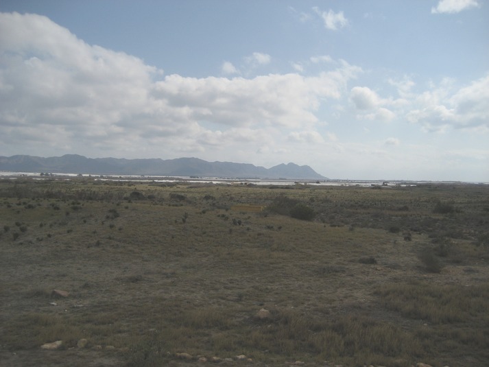
The geological development in Almería has documented the increase of landmass due to the collision with the African tectonic plate as well as due to voluminous volcanic eruptions. This image shows a volcanic mountain chain in the background and a large flat area. This region was covered by sea water until about 5 million years ago. Here, we can now see the greenhouse panorama. What is too far away to see are the Salinas. Salinas are marine salt plains that are used to harvest salt. We imagined what the consequences of a rise in sea-level would be for the region; a thought that could become reality in light of current global warming.
If the water level rises, these plains would be flooded by salty seawater and this could lead to saliniation of the groundwater. This process depends on the permeability of the ground beneath it but is likely to occur at several points. If we then think back to the botanical garden where we saw the types of plants able to live only in certain environments, the impact of a rise in sea level determines the existence of plant species here. Moreover, the impacts this would have go beyond the natural environment and also affect the inhabitants and industry.
Therefore, the geological record of the area is a good indicator of what occurred here in the past as well as a predictor for future conditions.