")

Danube Excursion: Munich—Deggendorf
Munich —> Winzer —> Mühlham —> Deggendorf
28.07.2017
The bus ride from Munich to Deggendorf along the Isar river
The landscape en route from Munich to Deggendorf is dominated by the flat valley of the river Isar. The river has carried a lot of material from the Alps to the lower part of the river near Deggendorf. This is the reason the soil here consists of an eight-meter-thick layer of river sediment. The Isar valley is surrounded by hills, in a landscape where erodible brown soil has been heavily deposited. The colluvium from this landscape, combined with the river sediments, makes the area the perfect place for agriculture (primarily sugar beet and corn). The Mühlbogental is an area near Deggendorf which has become the focus of concentrated industry; here lies a paper mill, as well as a BMW production site that was built on subsidies to discourage migration out of the region.
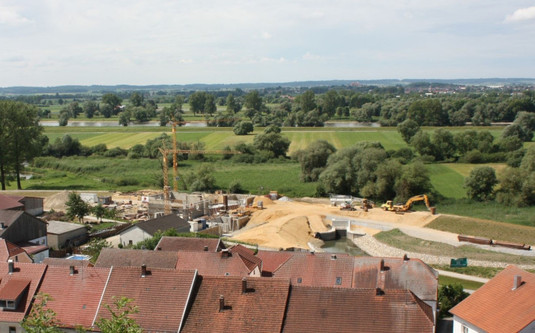
Construction of the new dike Photo: Martin Meiske, CC-BY 2.0.
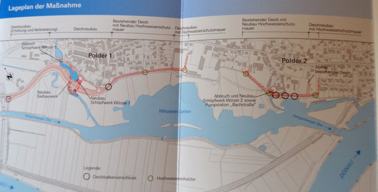
To the south of Deggendorf the Isar flows into the Danube (Donau in German), which was, in former days, only constrained in its meandering by the Bavarian Forest (a cool, infertile, and mountainous range dominated by gneiss) in the north east. Today, many dikes bound the naturally wandering landscape of the Danube, and the ancient current is limited by a row of hydropower plants spanning the whole of the Danube’s course through Bavaria. Together, the hydropower plants in Bavaria produce around 15 percent of Germany’s electricity supply. All the best spots for these plants have been occupied, which means that the expansion of hydropower is only possible if the plants become more efficient (to reach the goal of 17 percent). The flood defenses around Deggendorf were first installed in the 18th century and have since been expanded and modernized. Throughout the year (especially around June and August) numerous small flood events (below HQ 30) hit the area, but the dikes and polders usually prevent severe damage to surrounding communities.
The oxbow, or river loop: Mühlhamer Schleife
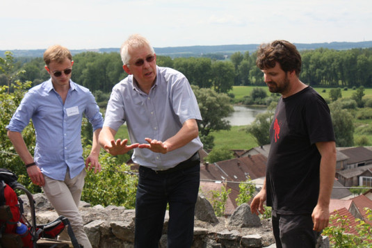
A few kilometers downstream from Deggendorf, there is a loop in the Danube known as the “Mühlhamer Schleife.” Here, the water is particularly shallow and the current strong, making it a problematic stretch for the shipping industry. Consequently, in 2013, the federal state of Bavaria planned to build a shipping channel with locks straight through the Mühlhamer Schleife. These locks would make it possible to ship on the Danube for more than 200 days of the year (the maximum number of shipping days in recent years). After big public protests that were spurred by the results of the forecasted impact of the channel and an inventory analysis by the ArGe Danubia, the project was put on hold. Thomas Liepold, hydraulic engineer, and Tobias Schiefer, ecologist, discussed the potential effects of the proposed canal on the ecology of the Danube.
Thomas Liepold and Tobias Schiefer discuss the possible impacts of a proposed shipping channel at the Mühlhamer Schleife. Photo Credit: David Stäblein.
Read the full article on Seeing the Woods.